Author Archives: vlm
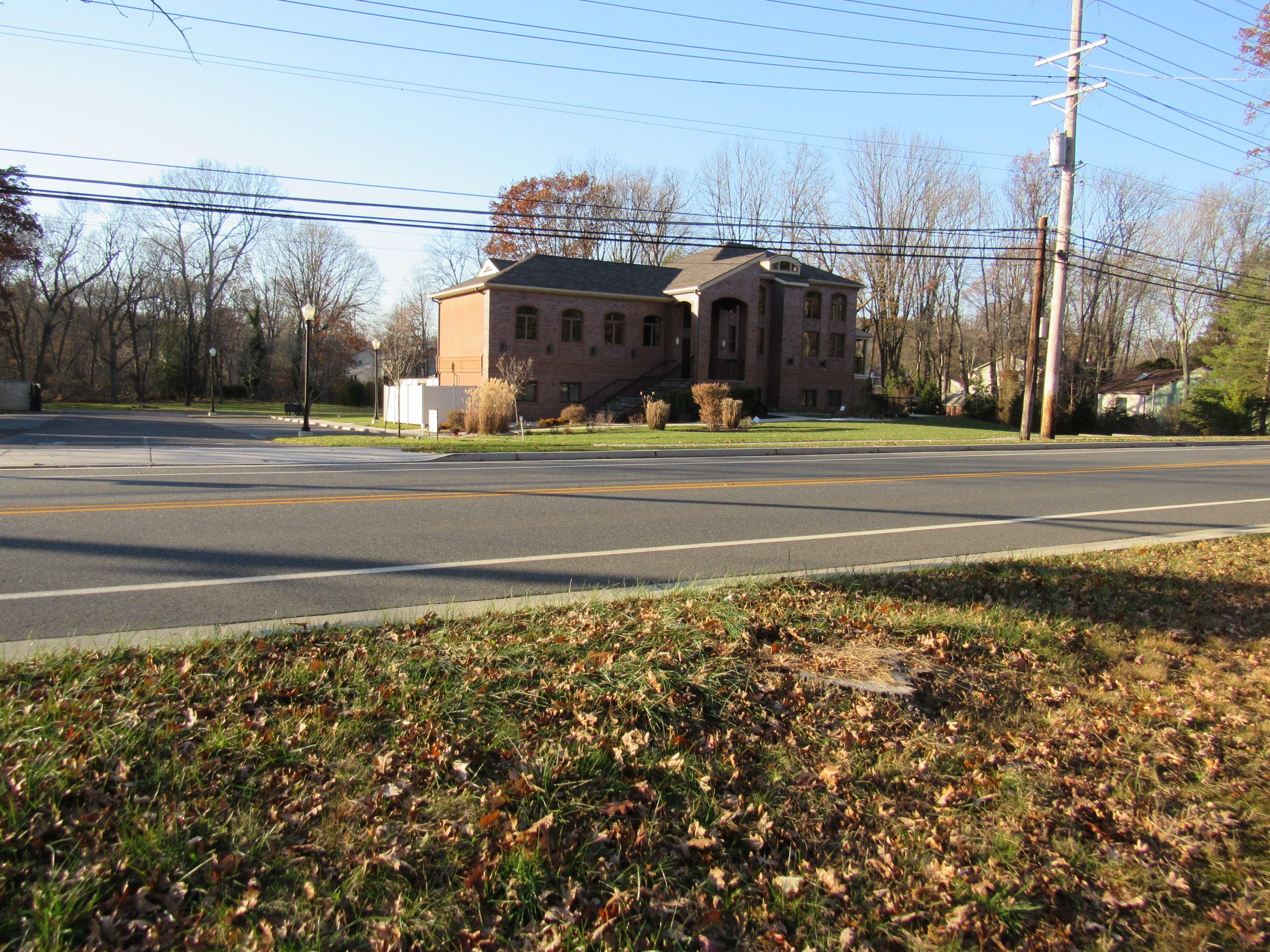
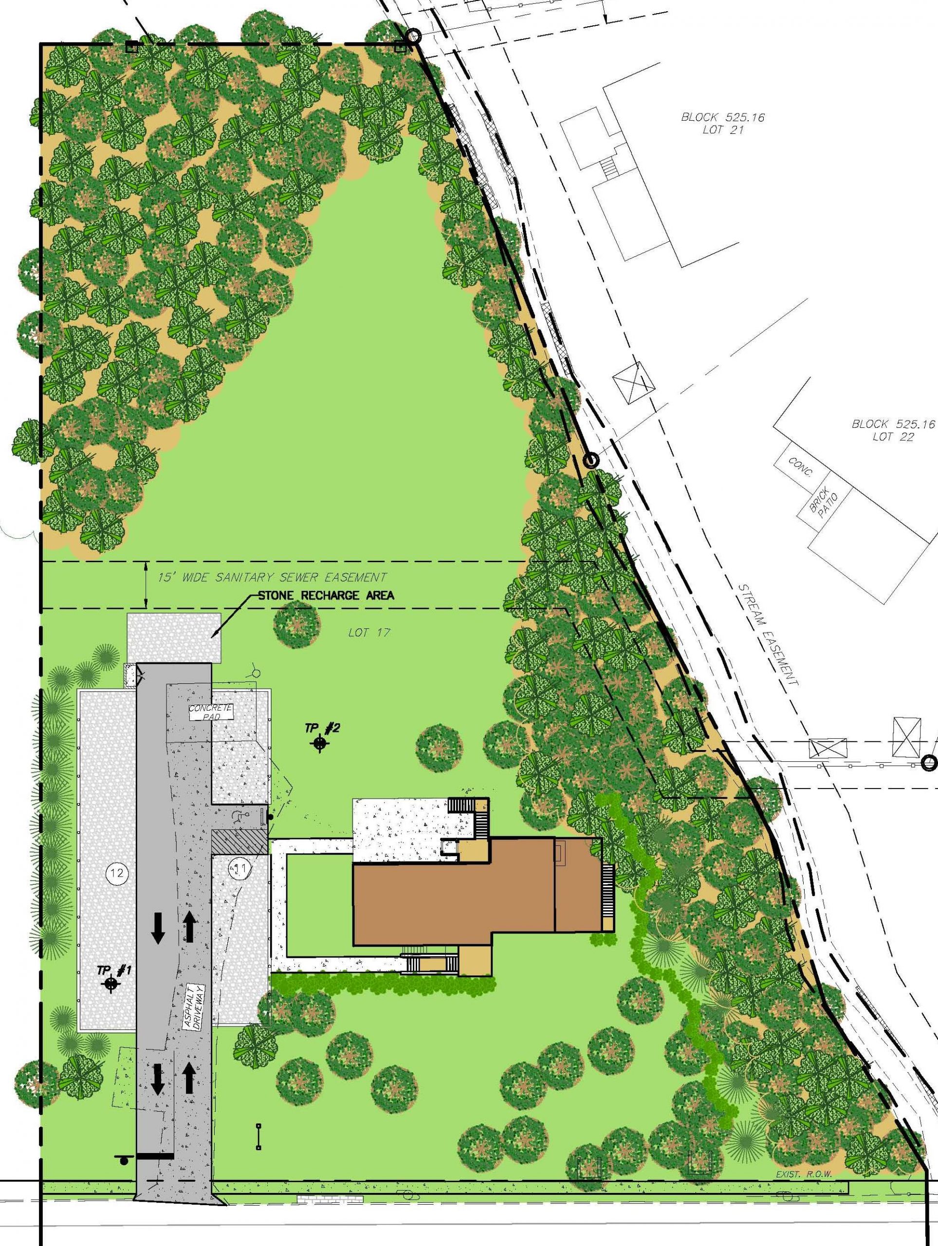
The Community Synagogue of Cherry Hill
Services:
- Surveying
- Site Planning
- ADA Access Design
Cherry Hill Township, Camden County, NJ – This project involved converting an existing dwelling into a synagogue for a small congregation and adding parking facilities. Porous pavement was utilized and surface drain was used in lieu of underground stormwater piping. Handicap access was a critical part of the design to allow accessibility to all levels without the installation of an elevator. Local and County Approvals were obtained.
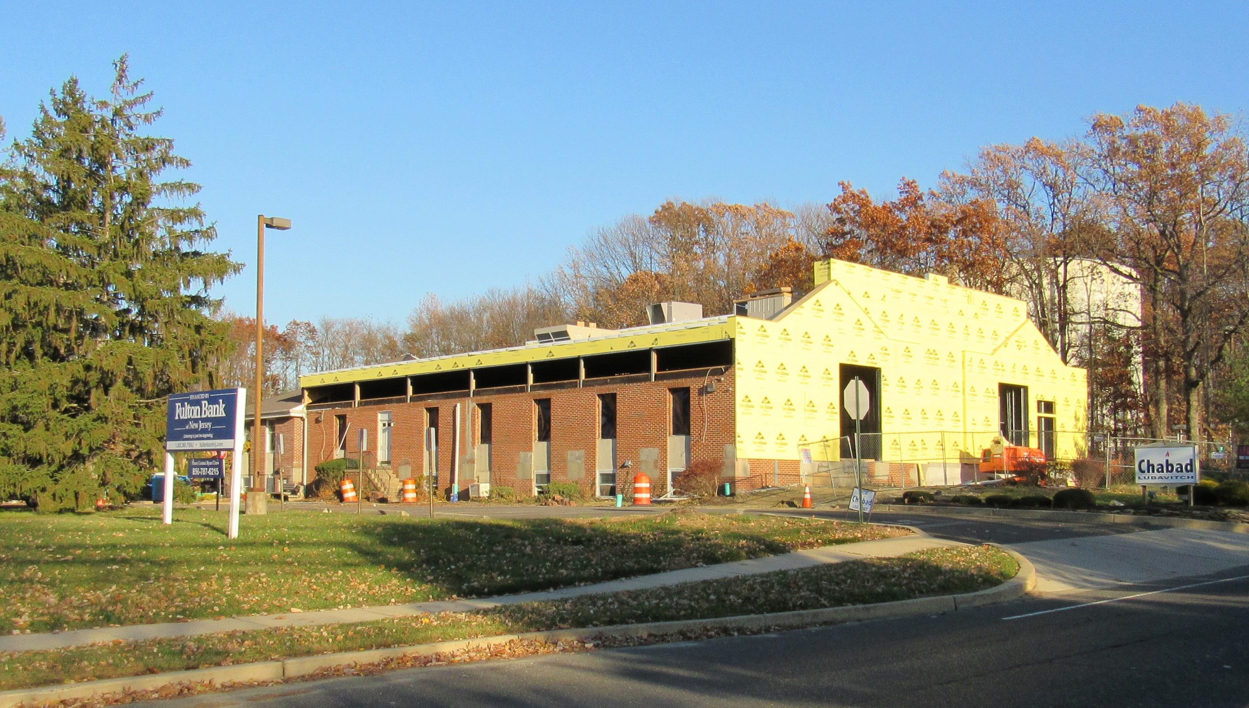
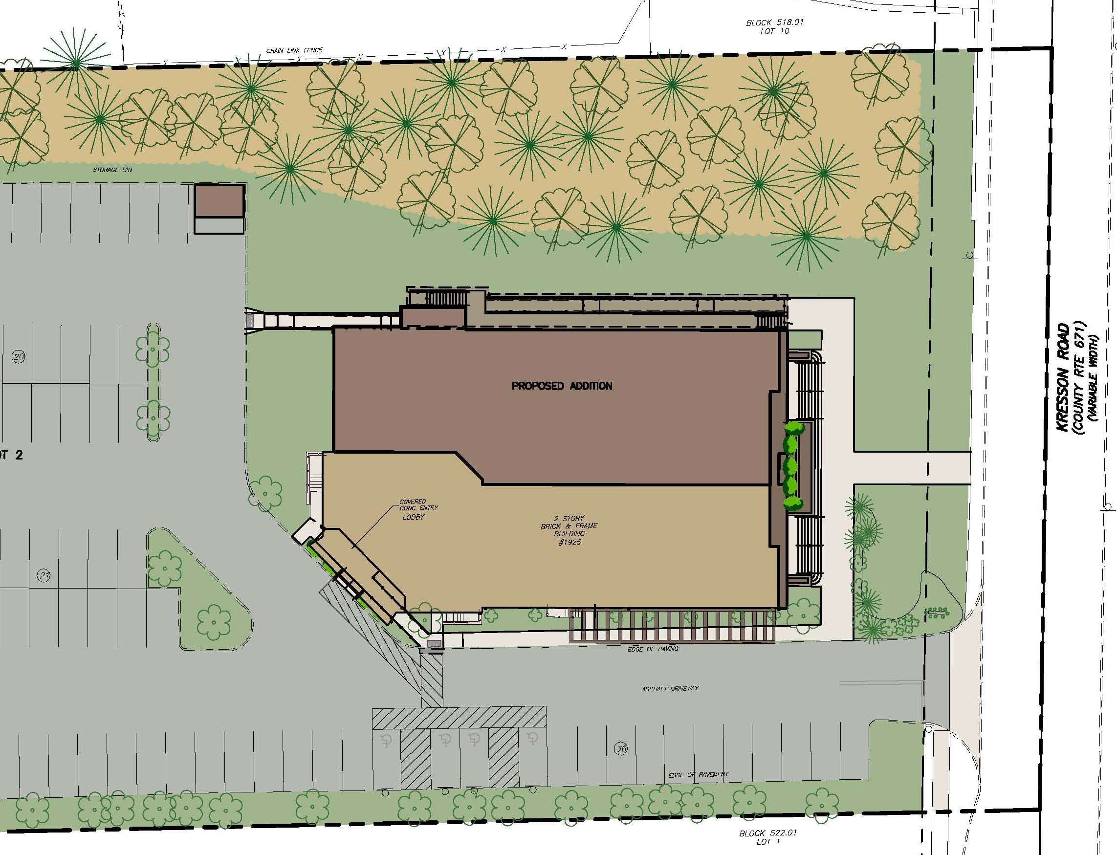
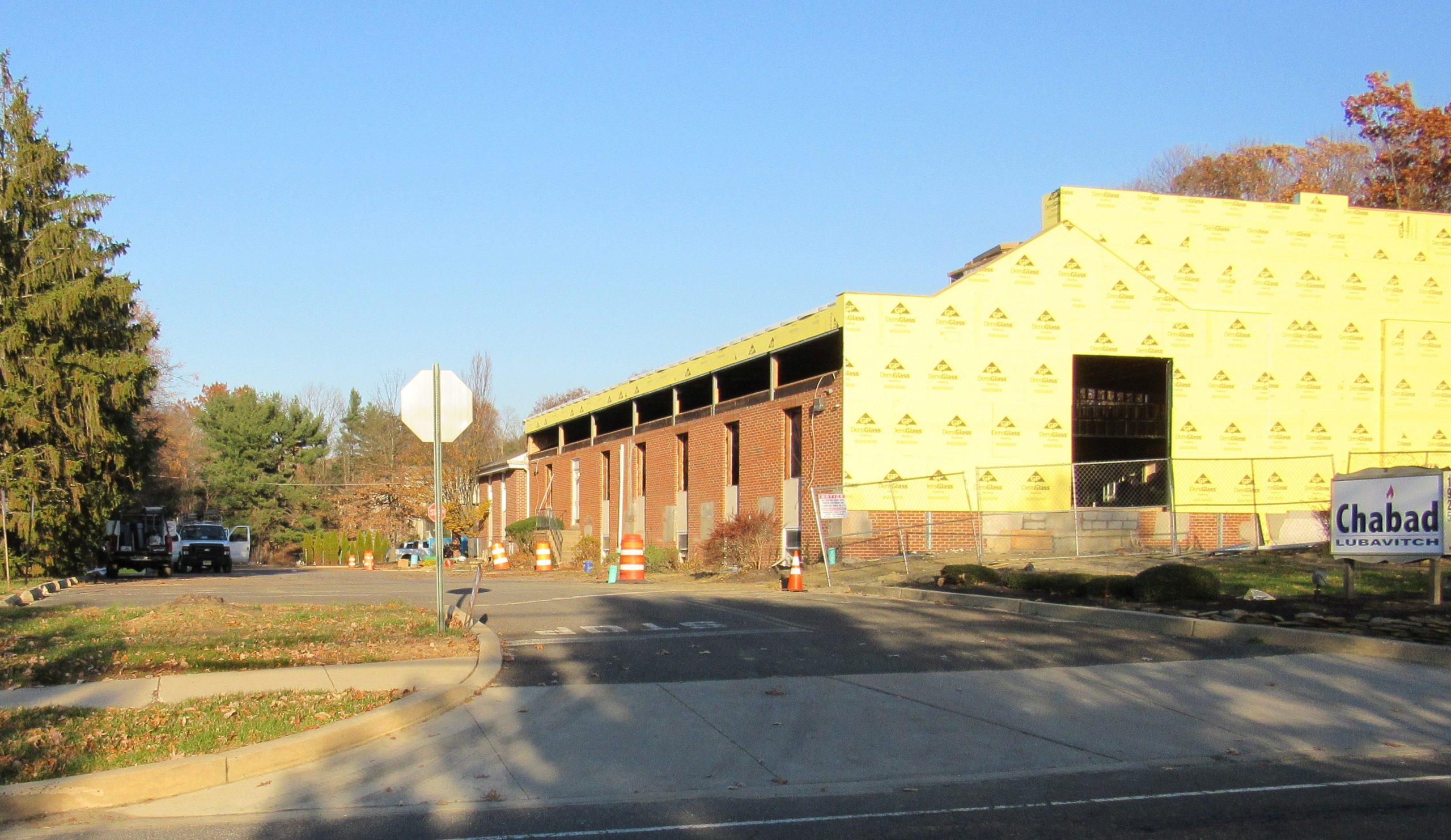
Chabad Lubavitch Building Expansion
Services:
- Surveying
- Site Planning
Cherry Hill Township, Camden County, NJ – This project involved the expansion of a multiple level synagogue which doubled the size of the facility. Local and County Approvals were obtained. A 2018 opening is expected.
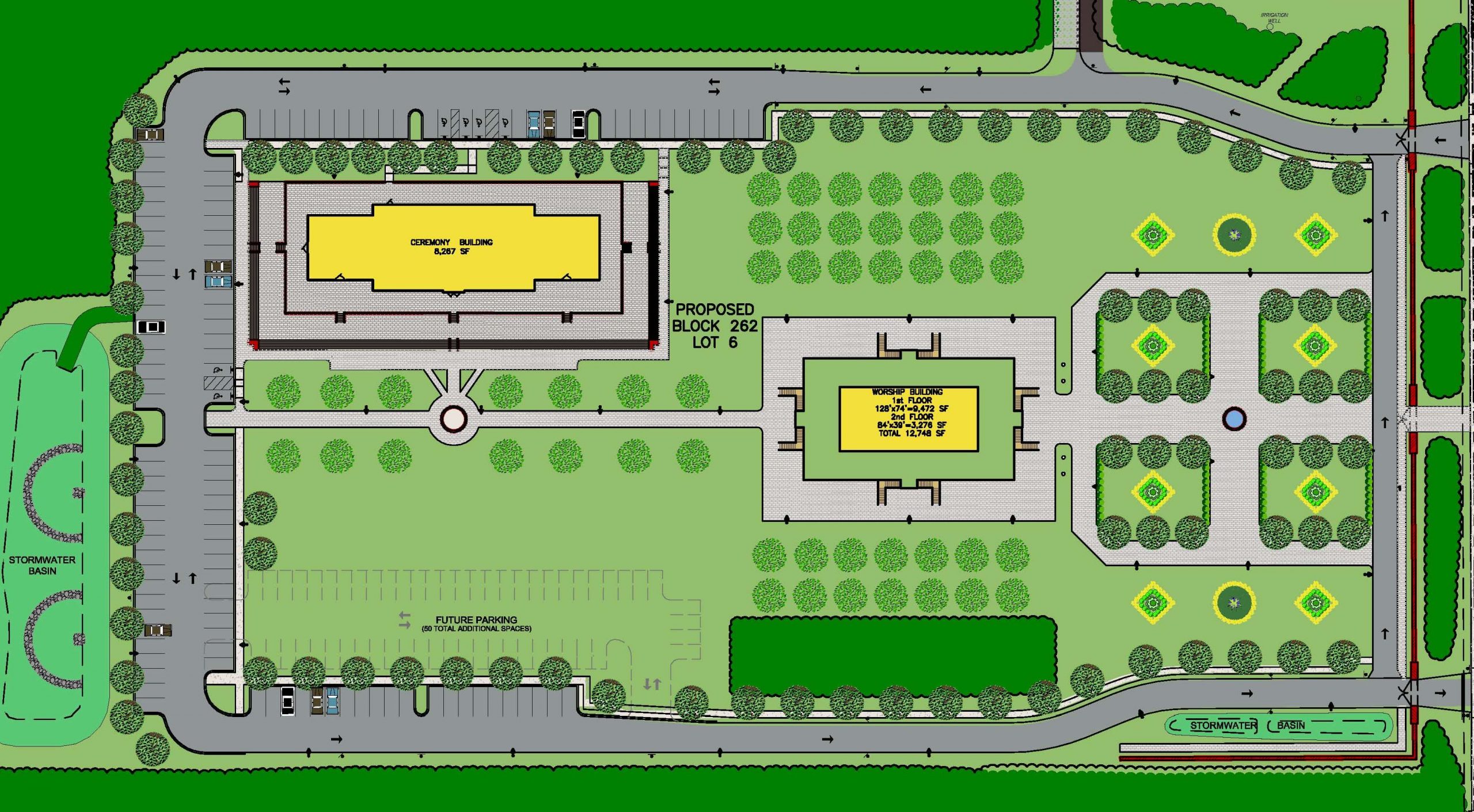
Khmer Buddhist Humanitarian Temple
Services:
- Surveying
- Site Planning
- Zoning Use Approvals
- Stormwater Management
- Water and Sewer Design
- Municipal Permitting
- Construction Engineering Services
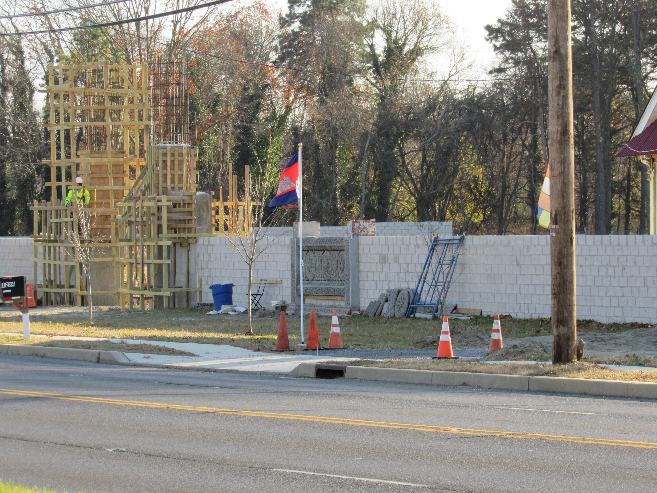
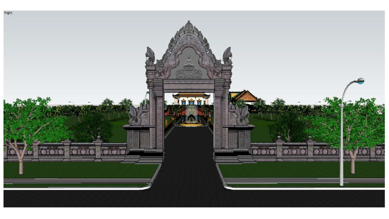
Voorhees Township, Camden County, NJ – CES’ ability to service unique clients has been demonstrated with our strong relationship with the Khmer Buddhist Humanitarian Association. We have assisted the Association in planning and developing a 15-acre parcel of land in Voorhees Township into a religious campus for prayer, meditation, and community gatherings. The completed site will include a multi-level worship building, community building, and residence all surrounded by vast open areas, heavy landscaped areas, and sculptured facades. Full infrastructure components included access, parking, drainage, utilities, and landscaping.
Stormwater Outfall Mapping
Services:
- Surveying
- GPS Data Collection
- GIS and CAD Mapping
- Assessment Reports for Utility
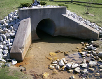
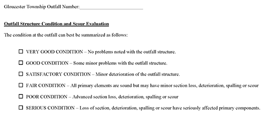
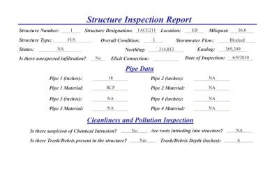
Gloucester Township, Camden County, NJ – As required by the New Jersey Stormwater Management Rules, CES provided outfall mapping and scour/illicit connection evaluations for the Township of Gloucester. CES located all storm outfall structures for the entire Township using GPS equipment.
CES completed inspection and condition assessment with the Township’s digital and paper format requirements, evaluated and documented each storm structure for structural and functional condition, and completed all reports and maps on schedule and within budget.
Water System Mapping
Services:
- Surveying
- GIS Mapping
- Utility Mapping
- ArcGIS and AutoCAD Map
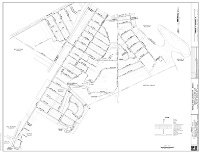
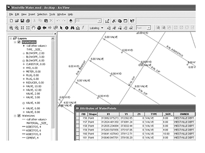
Borough of Westville, Gloucester County, NJ – CES performed AutoCAD and GIS mapping of the entire water system in the Borough of Westville. CES provided electronic CAD drawings of the water system and provided correlated GIS data. The data included field information for each structure and water line within the system. All data was coordinated with the Borough of Westville for accuracy. Water system data included adjacent municipalities serviced by the Borough of Westville.
The data has been incorporated into the GIS systems for Westville and New Jersey Department of Environmental Protection.
Stormwater Structure Assessment
Services:
- GIS Data Collection and Mapping
- ArcGIS
- AutoCAD Map
- Utility Inspection and Condition Assessment
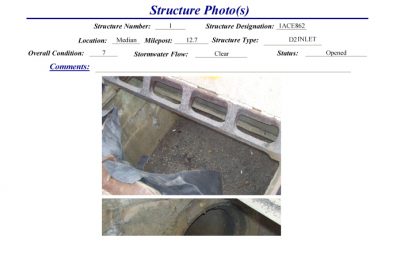
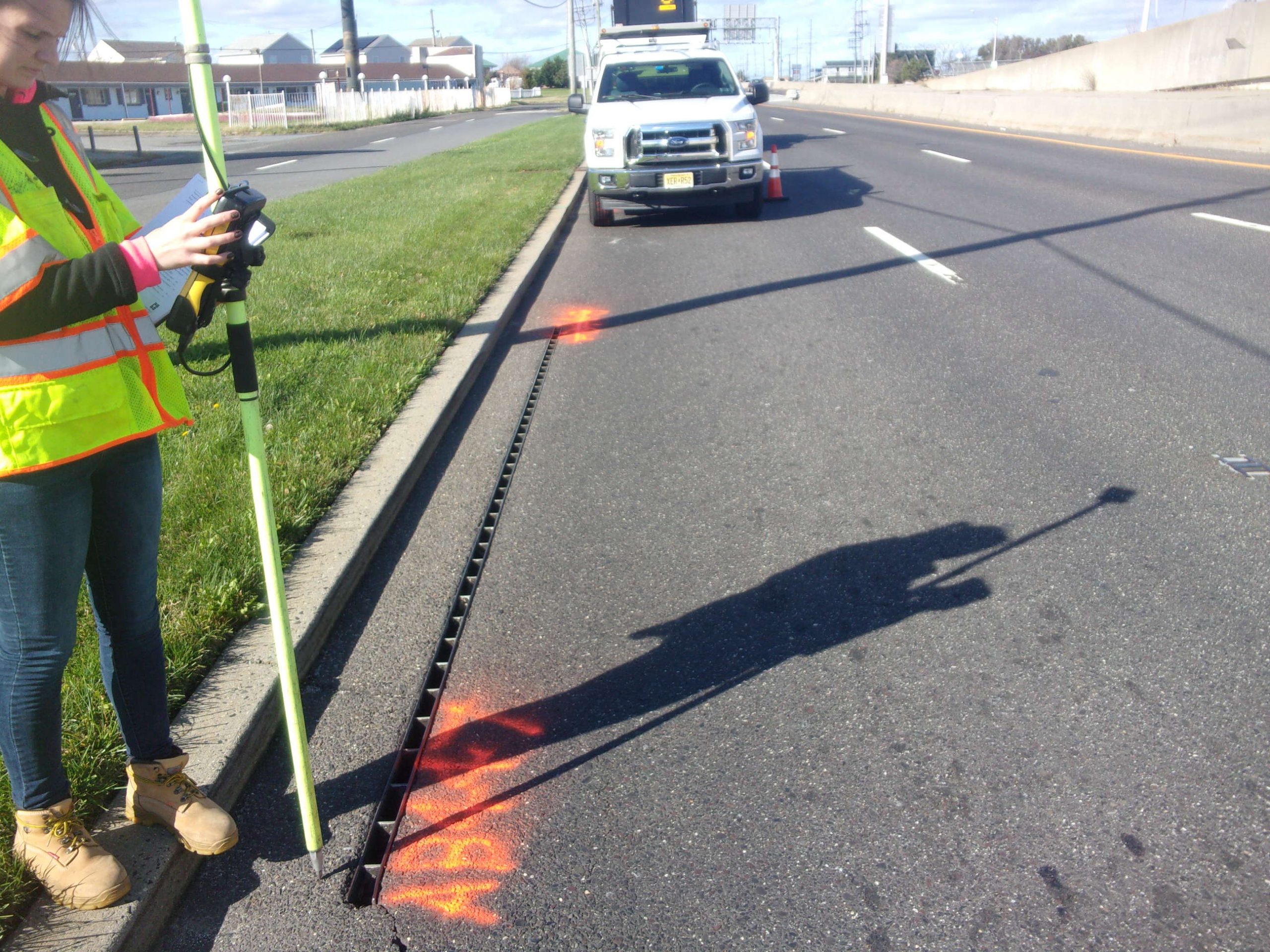
South Jersey Transportation Authority, Atlantic County, NJ – CES located and inspected stormwater structures along 40 miles of the Atlantic City Expressway. CES used GIS data collection tools with GPS equipment. Each stormwater structure was evaluated for structural and functional condition. CES produced reports for individual structures and queries of specific data for ongoing maintenance and inspections by South Jersey Transportation Authority.
CES provided GIS data in ArcGIS format for integration into the SJTA GIS system. This database information was incorporated into the SJTA Geographical Information System. CES also provided reports for individual structures with photos and specific data reports (queries) for SJTA’s ongoing maintenance and inspections of stormwater outfalls.
Hancock’s Bridge Bank Reconstruction
- Survey
- Alternatives Analysis
- Design
- NJDEP Permitting
- ACOE Permitting
- Construction Management
- Construction Inspection
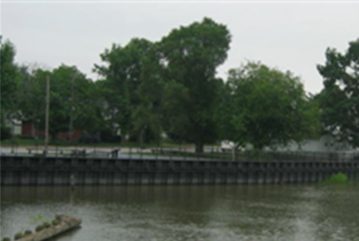
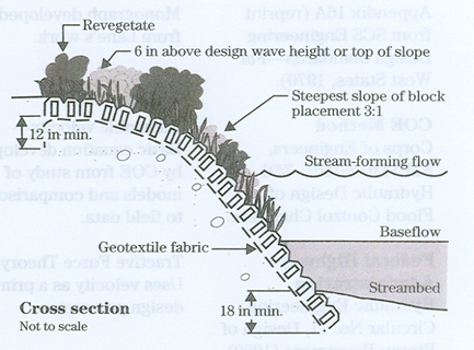
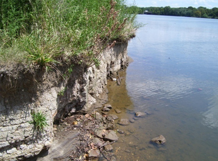
Cooper River and Newton Lake, Bank Stabilization Study
- Field Recon
- Mapping
- Stabilization Recommendations – Including alternative analysis and cost estimates
- Environmental Permit Requirements
- Report of Findings
CES studied the area from land and by boat, concluded the causes and made recommendations to reduce the amount of erosion. Our professionals noted bank stabilization alternatives, including vegetative measures, soil bio-engineering options, and structural measures, and researched environmental permitting requirements for the report. Given the large scope of the project, CES recommended a combination of solutions be incorporated over a period of years to correct the situation, while limiting the cost in any one year.
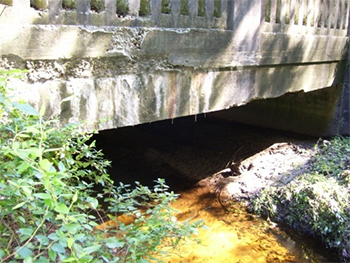
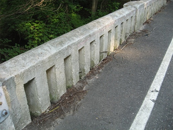
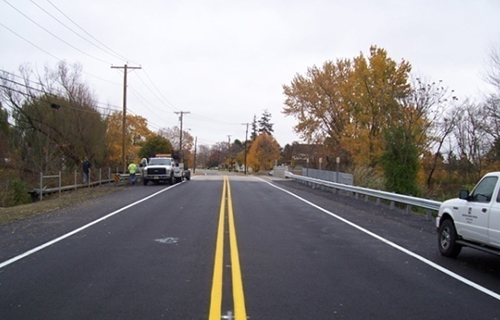
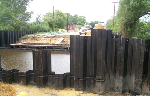
Canton Drain Bridge Replacement Main Street over Canton Drain
Services:
- Survey
- Design
- Permitting
- Construction Management
- Construction Inspection
Lower Alloway Creek Township, Salem County, NJ – To replace this deficient bridge, the project included demolition of the existing structure and replacing it with a new pre-stressed concrete box beam bridge. The plans included upgraded drainage, new wider sidewalks, curbs, approaches and sheet pile retaining walls.
Special attention was given to the environmental requirements of this coastal wetland and Bald Eagle foraging area.
Inspection included the review of all soil erosion control measures, required welding, and reinforcing rod arrangements. Activities also required review of utilities. A mislocated existing storm drain required revisions to stormwater design to adjust to it. Construction involved removal of existing pavement and installation of new pavement on approaches for both sides.
Houses Mill Pond Bridge County Bridge #1701-003
Services:
- Field Survey
- Right-of-Way
- Environmental Permitting
- Alternatives Analysis Conceptual Design Permitting
- Bid Documents
- Construction Management
- Construction Inspection